SOUTH24 CENTER FOR NEWS & STUDIES
SOUTH24 CENTER FOR NEWS & STUDIES


08-11-2026 at 1 PM Aden Time

Aden (South24 Center)
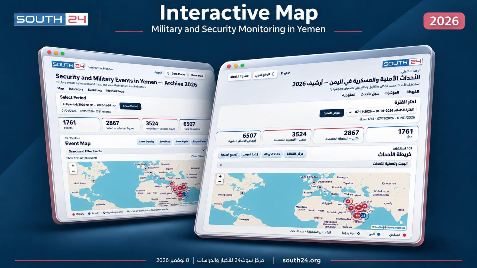
South24 Center for News and Studies launched its comprehensive interactive map tracking military and security events in Yemen on Sunday (November 8, 2026). Available in Arabic and English, the platform brings together event documentation, geographic distribution and statistical indicators in a single searchable resource for the public, researchers, journalists and specialists.
At launch, the project contains 1,761 records covering January 1 through November 7, 2026, as part of the current year’s archive, with data updated daily. It allows users to track events in South Yemen and North Yemen, along with related regional developments and cross-border incidents, by linking each event’s details to its location, date, parties involved and reported casualties.
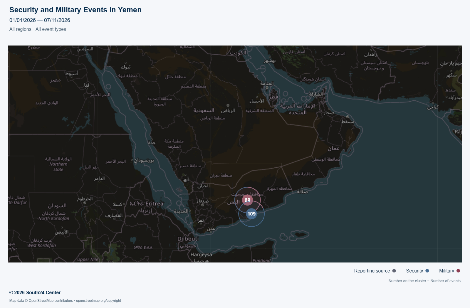
The project extends the Center’s news coverage and research into data journalism and visual monitoring, transforming a substantial body of reporting, statements and documents into a structured archive. Users can reconstruct sequences of events, compare periods and regions, and explore patterns in military and security activity and how they change over time.
The platform comprises four interconnected sections: an events map, indicators and charts, a detailed event log, and sources and methodology. Visitors can explore the entire available period, select a specific month or define a date range relevant to their research.
The map provides search and filtering tools covering region, operation type, acting party and casualty category. Users can move from a record to the event’s location on the map and read its details. A density view also highlights concentrations of events, helping users assess their geographic distribution and identify areas of heightened activity during the selected period.
The archive covers a wide range of events, including airstrikes, clashes, ground attacks, artillery and rocket fire, drone attacks and aerial interceptions, as well as military deployments and movements, security operations, raids, arrests, shootings, mines and explosions.
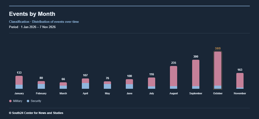
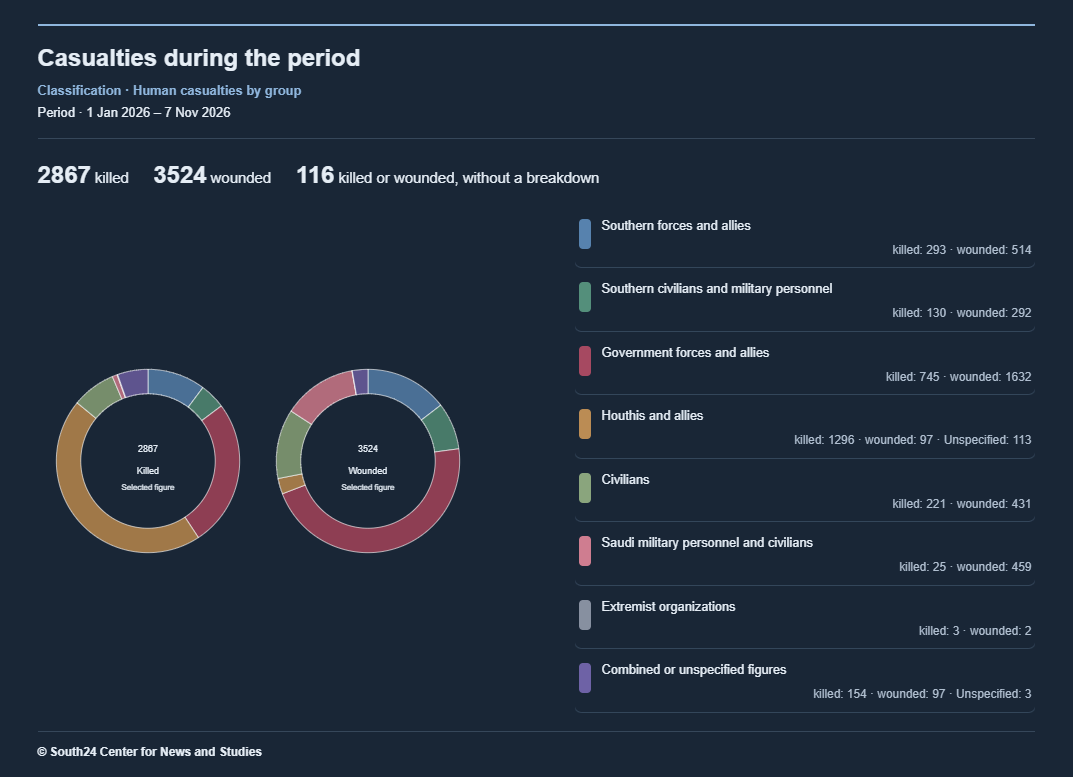
Charts show changes in monthly event counts, the areas recording the most events and types of operations, alongside casualty breakdowns by party and status. Users can navigate from casualty categories to the associated records to examine the events underlying the figures.
The platform provides a separate view of announced cumulative casualty figures, identifying the reporting parties and the periods covered. These figures are excluded from the main casualty total where there is potential overlap. This allows users to interpret the numbers in context and distinguish between casualties documented in individual events and broader announcements by parties to the conflict and other entities.
For researchers and specialists, the service offers structured material for studying trends in violence, the distribution of events and changes in the means of warfare, as well as comparing military and security activity across regions and periods. It helps journalists prepare timelines and data-supported reporting, and retrieve event details without having to search through scattered news reports.
Users can also save images of the map and charts for reports, studies and presentations, with attribution to South24 Center and identification of the period displayed. Links to the map or individual events can be shared for ease of reference. The English version broadens access to the project for research institutions, media organizations and international audiences.
Monitoring draws on South24 Center’s daily coverage, official statements, documents, local and official media outlets, news agencies and other sources. The published methodology explains the scope of documentation and how to interpret the indicators. Source-supported additions and corrections can be submitted through the map’s dedicated email address. The map was developed using modern technological tools and AI assistance, with daily verification and data checks carried out by a specialized team.
With this launch, the Center makes a monitoring and data archive publicly accessible, combining daily event tracking with the ability to revisit and analyze developments in their temporal and geographic contexts. It provides an additional tool for understanding the military and security landscape and its human and humanitarian consequences.
Previous article